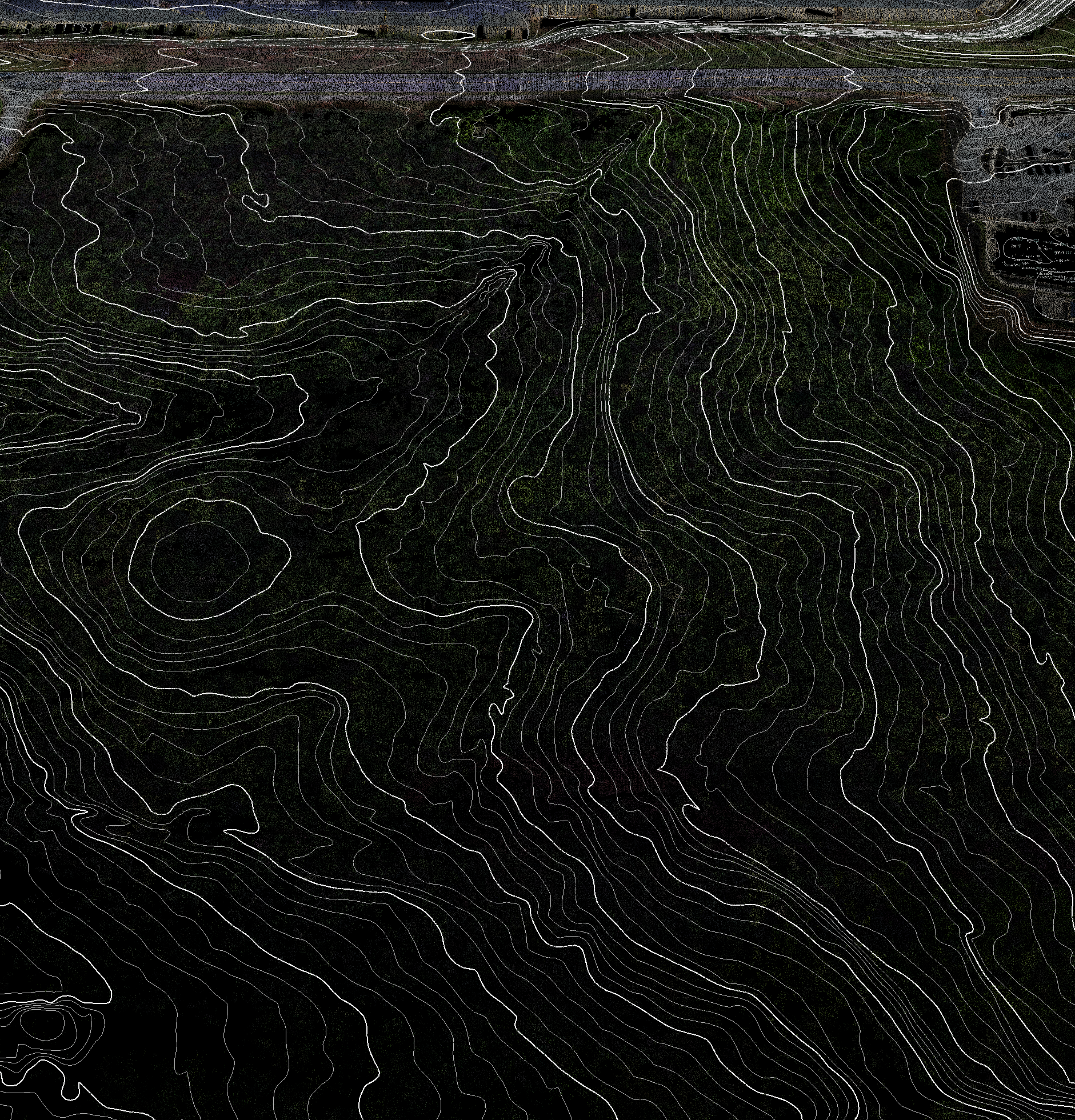

The versatility of aerial and ground-based LiDAR mapping services opens the door to accurate data collection in all kinds of environments. Whether it’s steep terrain, a heavily vegetated forest, or night operations, LiDAR technology proves time and time again that there is no task too tall. Basemap collects data ranging from design-level to large-scale topographic mapping with LiDAR. From construction site cut/fill analysis to full survey-grade mapping, the applications are endless!

Basemap always keeps a finger on the pulse of the LiDAR industry, leveraging the latest advancements in LiDAR sensors, software, and processing techniques. Seamless drone integration has led to survey-grade, repeatable workflows and highly accurate 3D LiDAR data. We utilize ground truthing via ground control targets and field-run checks to ensure the data is precise and meets the highest survey-grade standards. This ensures our LiDAR mapping solutions are consistently reliable.

LiDAR acquisition is undoubtedly one of the most efficient ways to collect geospatial data. Basemap consistently delivers jobs that traditionally took months using field surveys in just days or weeks. Integrating drone-based LiDAR mapping into your workflow reduces backlog and significantly increases the scale and number of jobs you can complete each year. Basemap provides a turnkey LiDAR mapping solution that seamlessly integrates into your operations without hassle or delays, helping to elevate your business.