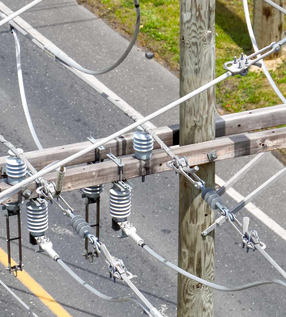
Aerial data collection is revolutionizing utility inspections, allowing for efficient large-scale asset monitoring with unmatched accuracy and speed. At Basemap Consulting, we specialize in distribution and utility pole inspections, providing utility companies and infrastructure managers with comprehensive, georeferenced datasets to improve asset management, maintenance planning, and compliance tracking.
By leveraging LiDAR, photogrammetry, and high-resolution imaging, our drone-based utility inspections offer:
high-speed, high-accuracy data collection across extensive networks
eliminating the need for costly manual inspections.
Detailed analysis of poles, crossarms, transformers, and insulators,
identifying structural weaknesses, vegetation encroachment, and other risk factors.
Consistent, repeatable data collection
for ongoing infrastructure monitoring, helping mitigate risks before failures occur.
Our approach reduces operational downtime, enhances safety, and provides utility companies with the data needed to make proactive decisions. Whether for routine inspections or large-scale infrastructure assessments, Basemap Consulting delivers high-precision, scalable solutions to optimize utility asset management.
Disaster Relief Data Insights: High-Accuracy Reality Capture for Rapid Response
When disaster strikes, accurate, large-scale geospatial data is critical for response, recovery, and reconstruction efforts. Basemap Consulting’s aerial data solutions provide detailed, real-time insights that aid government agencies, emergency response teams, and infrastructure managers in assessing widespread damage and expediting relief efforts.
Our aerial disaster assessment services include:
✅ High-resolution, georeferenced mapping of disaster-affected areas, providing a complete overview for response teams. ✅ LiDAR-based terrain and structural analysis, identifying compromised infrastructure, road obstructions, and environmental hazards. ✅ Baseline and post-disaster comparisons, offering precise change detection for assessing damage severity and prioritizing relief efforts.
By replacing manual damage assessments with fast, data-driven insights, our drone-based disaster relief solutions enhance situational awareness, accelerate decision-making, and improve coordination between agencies. With a focus on high-accuracy, large-scale data capture, Basemap Consulting supports disaster recovery efforts with reliable, actionable intelligence.
Work With Us
Whether you need large-scale utility inspections or disaster response data, Basemap Consulting provides cutting-edge aerial solutions tailored to your needs. Our expertise in LiDAR, photogrammetry, and advanced geospatial analytics ensures that you receive the most accurate, timely data to support critical decision-making.